COMMANDER
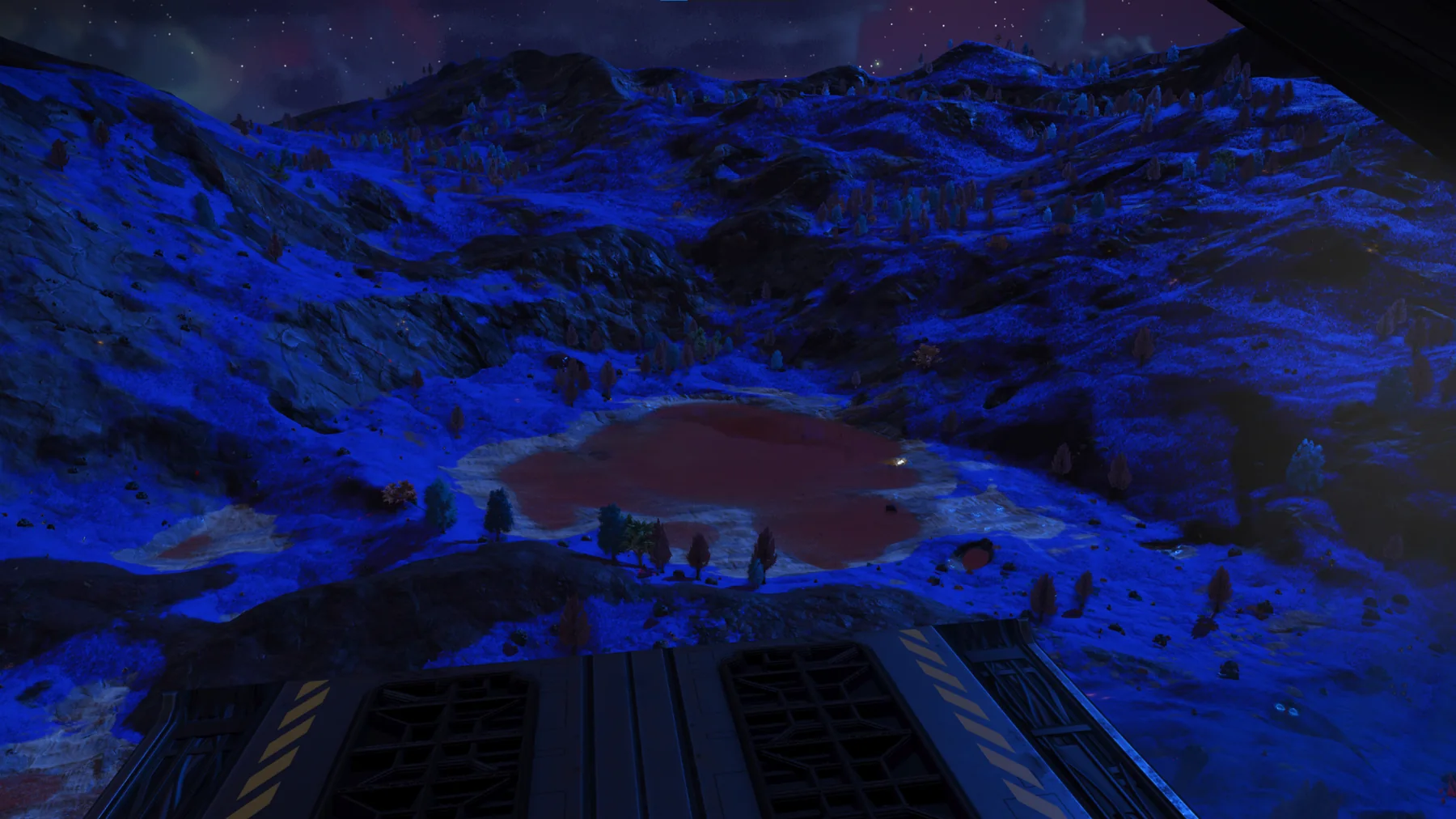
Aster, I have visual contact with the northern basin. The depression is broader than it appeared from orbit. Standing water occupies much of the basin floor, with pale exposed sediment along the shoreline and dense violet vegetation extending across the surrounding slopes.
ASTER
Visual telemetry received. Terrain geometry is consistent with a long-established collection basin rather than a recent impact feature. Surface-liquid retention appears stable. Mineral reflectance is elevated along the northern and western slopes.
COMMANDER
I’m also seeing substantial aerial activity above the water. Multiple organisms are crossing the basin at different elevations. Vegetation density is highest around the shoreline and lower terraces.
ASTER
Biosignature overlap confirmed. The region contains multiple mobile contacts and extensive stationary biomass. Current altitude prevents individual classification. Direct field observation will be required.
COMMANDER
Landing terrain looks uneven, but there is a clear approach corridor along the southern edge. Weather remains stable. No immediate obstruction from sentinel patrols.
ASTER
Approach corridor mapped. Atmospheric conditions remain within operational limits. Sentinel activity is present but does not currently intersect the proposed descent path.
COMMANDER
This site gives us water, exposed geology, dense flora, and active fauna in one region. It should provide a strong baseline for the first surface survey.
ASTER
Assessment concurs. Recommend designation as Survey Site Alpha and authorization of controlled descent.
COMMANDER
Designation confirmed. Beginning descent.
ASTER
Survey Site Alpha registered. Explorer Log EX-1A-SLG-001A authenticated. Surface deployment authorized.
TRANSMISSION AUTHENTICATION
Transmission IntegrityVERIFIED
Archive AuthenticationASTER
Field SourceMALWVRE_TTV
ChecksumVALID